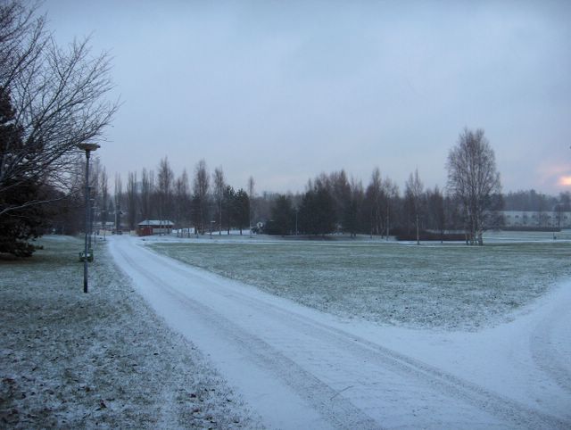
Kuvan tilanteessa satoi hyvin heikosti lunta, jota oli kertynyt kuvassa nähtävä määrä edellisestä päivästä lähtien. Ilman lämpötila vaihteli -9,1 ja +0,6 asteen välillä siten, että päivän aikana sää kylmeni koko ajan koillisesta virranneen ilmamassan takia. Tuulet olivat kuitenkin heikkoja, sillä eteläisen Suomen yllä oli laajan matalapaineen keskus. Sen siirryttyä kylmä ilma pääsi myös kuvauspaikalle. Pilvinä kuvassa olivat sumu- ja sadepilvet. Maa oli yhä edelleen muutamia senttejä jäässä huolimatta 10. - 16.12. vallinneesta leudommasta sääjaksosta; lähes koko ajan suojaa. Säätilanne: valitse 16.12.2005; Wetter3 A. Wetter3 B.
In the situation of the picture it was snowing very slightly. As seen in the picture the snowcover was formed from the day before onwards. The temperature changed between -9,1 C and +0,6 C during the day in the way that it was getting colder all the time due to a air mass flown from the northeast. The winds were were weak though, because the center of a wide low pressure was over southern Finland. When it moved the colder air streamed also to the photoshooting scene. The clouds in the picture were stratus and nimbostratus clouds. The soil was still frozen for a few centimetres despite a milder weather period between 10th and 16th of December; allmost all the time thaw. Weather condition: choose 16.12.2005; Wetter3 A. Wetter3 B.
Helsingin Puistolan säätilasto joulukuussa 2005 - Weather chart of Puistola, Helsinki in December 2005.
Flickr 1 Flickr 2

posted by Mika at
10:12 AM
![]()


0 Comments:
Post a Comment
<< Home