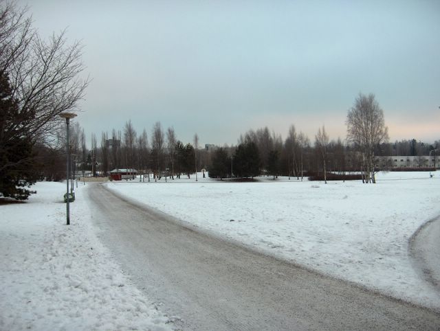
Samanlainen korkeapaine ja heikko pakkanen olivat jatkuneet useita päiviä, mutta kuvauspäivänä leudot länsi- ja lounaistuulet alkoivat vahitellen voimistua. Merkkinä siitä olivat kuvan aikaisempaa runsaammat sumupilvet. Koko päivän oli kuitenkin yhä edelleen pakkasta -6,1 ja -2,8 asteen välillä. Keskitalvella (joulu- ja tammikuussa) korkeapainetilanteessa pilvisyyden aste määrää lämpötilan vaihtelun keskipäivälläkin yön tapaan vähäisen auringonsäteilyn takia; mitä selkeämpää on, niin sitä kylmempää on ilma. Lämpötilan vuorokausivaihtelu katoaa samoin usein pilvisyyden vaihteluiden aiheuttamiin lämpötilan muutoksiin loka - helmikuussa. Lumipeitteen tilanne oli lähes sama aikaisemmasta lähes sateettomasta pakkassäästä johtuen, mutta ihmisten jäljet olivat lisääntyneet. Säätilanne: valitse 9.1.2006; Wetter3 A. Wetter3 B.
The same kind of high pressure and a weak frost had been continued for several days, but in the photoshooting day mild west and southwesterly winds were picking up slowly. As a mark for that there was more stratus clouds in the photo than previously. However the temperature was all day still between -6,1 C and -2,8 C. In midwinter (december - january) during a high pressure the quantity of clouds rule the changes in temperature even at noon like at night, because of the minimal amount of the radiation of the sun; the clearer it is the colder the air gets. Likewise in october - february the cycle of night and daytime temperature often disappears under the changes of temperature caused by the variation of clouds. The condition of the snowcover was allmost unchanged due to the previous frost and allmost no precipitation, but tracks made by people had been increased though. Weather condition: choose 9.1.2006; Wetter3 A. Wetter3 B.
Helsingin Puistolan säätilasto tammikuussa 2006 - Weather chart of Puistola, Helsinki in January 2006.
Flickr 1 Flickr 2

posted by Mika at
2:54 PM
![]()


0 Comments:
Post a Comment
<< Home