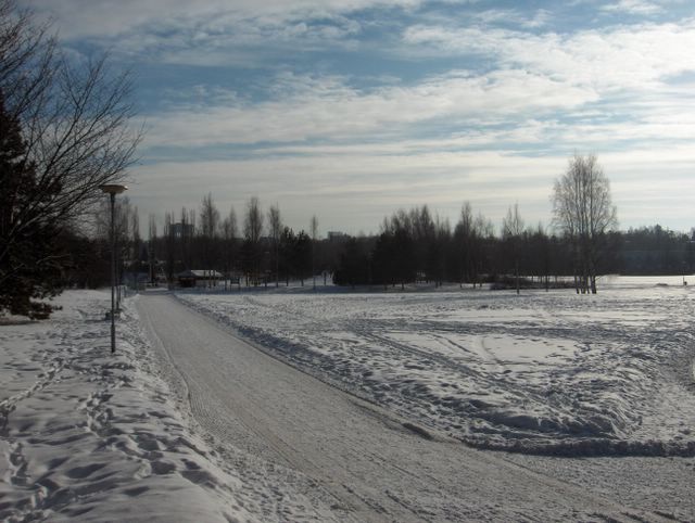
Tässä nähdään pienen matalapaineen rintamapilvien vähentyneen vain untuva-, pallero- ja hahtuvapilvinauhoiksi. Ko. matalapaine oli juuri kulkenut Suomen yli luoteesta kaakkoon. Edellisenä yönä satoi vielä vähän lunta. Sään selkeneminen tiesi aikaisempaa kylmempää seuraavaa yötä ja lämpötila oli alimmillaan myöhään illalla -12,5 astetta. Päivällä aurinko kuitenkin lämmitti jo varsin tehokkaasti ja päivälämpötila olikin ylimmillään -0,1 astetta. Kuvassa nähdään, kuinka auringonvalo oli lisääntynyt verrattuna vastaavaan tilanteeseen kuvassa 28. tammikuuta. Näin leutona päivänä tämä tiesi lumen ja jään selvää sulamista tummilta pinnoilta (kts. albedo), mutta ei vielä muualta. Säätilanne: valitse 22.2.2006; Wetter3 A. Wetter3 B.
In here we see a weather front related clouds of a small low pressure decreased into only stripes of cirrus, cirrocumulus and altocumulus clouds. The low pressure had just been crossed Finland from the northwest to the southeast. During the night before it snowed yet a little. The clearing of the weather meant colder next night than before and the temperature was -12,5 C at lowest late in the evening. However during the day the sun warmed up the air allready fairly effectively and so the daytime temperature was -0,1 at highest. In the picture we see, how the sunlight had been incresed as compared to the similar situation in the photo of the 28th of January. In such a mild day this meant obvious melting of the ice and snow from the dark surfaces (check albedo), but not yet elsewhere. Weather condition: choose 22.2.2006; Wetter3 A. Wetter3 B.
Helsingin Puistolan säätilasto helmikuussa 2006 - Weather chart of Puistola, Helsinki in February 2006.
Flickr 1 Flickr 2

posted by Mika at
11:03 AM
![]()


0 Comments:
Post a Comment
<< Home