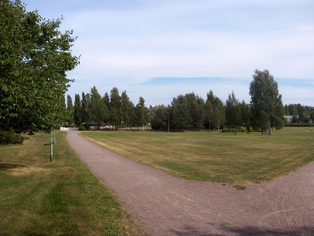
Kesän neljäs helleaalto oli tässä tilanteessa päättymässä, kun Etelä-Suomen yllä ollut korkeapaine oli heikentynyt ja siirtynyt etelämmäksi. Sen takia jo muutamia päiviä Norjan länsirannikon lähellä sijainnut rintamavyöhyke alkoi ylittää Suomea luoteesta. Samassa yhteydessä Lappiin muodostui uusi matalapaine, joka voimisti ko. päivänä länsituulia. Ko. kylmän rintaman ylitys näkyi kuvauspaikalla aluksi untuvapilvinä, mutta kuvaustilanteessa koko taivaan peitti harso- ja verhopilvet rintaman suuntaisina kilpinä. Paikoin oli hahtuvapilviä (kuten kuvassa taivaanrannassa) ja kumpukerrospilviä. Aurinko pääsi kuitenkin kuultamaan melkein koko ajan pilvien läpi. Vain sisämaassa kehittyi paikoin kuuro- ja ukkospilviä, mutta etelärannikolla jatkui käytännössä sateeton sää. Rintaman etupuolella oli vielä hellettä; kuvausalueella oli +27,3 astetta ylimmillään. Kuvan nurmikon kasvu oli siis tyrehtynyt ja siten sen leikkaustarve loppui. Ennen tätä sitä leikattiin ko. kasvukaudella n. 5 kertaa (eri osia leikattiin eri tahtiin). Kuivan sään vaikutukset näkyivät tässä vaiheessa myös kasvun eroina kosteiden ja kuivien alueiden kesken, koska kuivuus yhtäältä hidasti kasvua ja toisaalta kosteilla alueilla suuri lämmön määrä näkyi vielä nopeana kasvuna. Niinpä hedelmien kehityksessä oli nyt esim. kotipihlajan (Sorbus aucuparia) tai omenapuiden (Malus domestica) kohdalla selviä eroja eri kasvupaikkojen kesken. Alla mainitun tehoisan lämpösumman kasvun tilannetta kuvaava aspekti alkoi siis vääristyä yhä enemmän kuivilla kasvupaikoilla jääden jälkeen summan paljastamasta arvosta. Säätilanne: valitse 4.7.2006; Wetter3 A. Wetter3 B.
The fourth heatwave of the summer was ending at this stage, as the high pressure over southern Finland had been weakened and moved more to the south. Due to that a frontal zone situated allready for couple of days near the western coast of Norway started to cross Finland from the northwest. At the same time there formed a new low pressure over Lapland, which strengthened westerly winds during this day. The crossing of this cold front in question was apprearing in the photoshooting scene at first as cirrus clouds, but in the photoshooting situation the sky was completely covered by cirrostratus and altostratus clouds as shields along the direction of the front. Locally there were altocumulus clouds (as in the horizon in the photo) and stratocumulus clouds. However the sun was able to glow through the clouds allmost all the time. Only in inland areas there formed locally shower- and thunderclouds (cumulonimbus clouds), but by the southern coast there continued rainless weather in practice. There was yet hot weather in the foreside of the front; in the photoshooting area there was +27,3 C at highest. So the growth of the lawn in the picture was ended and therefore the need of mowing it stopped. Before this it was mowed about 5 times (different parts were mowed in various intervalls) during this growing season. Influences of the dry weather were showing at this stage also as differences of growth between dry and moist areas, because the drought in one hand slowed down the growth and on the other hand the big amount of warmth was yet showing as a fast rate of growth in moist areas. Therefore in the progress of fruits for example concerning Rowan / European Mountain Ash (Sorbus aucuparia) or Apple trees (Malus domestica) there were clear differences between different localitys. So the aspect of the growing's stage described by the value of the effective temperature sum mentioned underneath started to become distorted in dry localitys ever more as leaving behind from the value revealed by the sum. Weather condition: choose 4.7.2006; Wetter3 A. Wetter3 B.
Helsingin Puistolan säätilasto heinäkuussa 2006 - Weather chart of Puistola, Helsinki in July 2006.
Flickr 1 Flickr 2
Tehoisa lämpösumma - The Effective Temperature Sum: 584,6
posted by Mika at
4:21 PM
![]()


0 Comments:
Post a Comment
<< Home